2012
NS2907 : Mochrum view
taken 12 years ago, 3 km from Maybole, South Ayrshire, Scotland
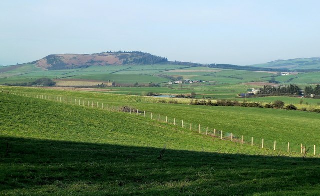
Mochrum view
Looking towards Mochrum Hill from the Carrick Way on the lower slopes of Kildoon Hill. In the background and located in adjacent squares are, from the left, Baltersan Castle, the old Glenside Reservoir and Glenside Farm.
 Map © Crown Copyright")
TIP: Click the map for more Large scale mapping
- Grid Square
- NS2907, 109 images (more nearby 🔍)
- Photographer
- Mary and Angus Hogg (more nearby)
- Date Taken
- Monday, 30 January, 2012 (more nearby)
- Submitted
- Monday, 30 January, 2012
- Subject Location
-
OSGB36:
 NS 2936 0764 [10m precision]
WGS84: 55:19.9866N 4:41.5026W - Camera Location
-
OSGB36: NS 2949 0755
- View Direction
- West-northwest (about 292 degrees)