2012
NS7653 : Flood debris and the Clyde Walkway
taken 12 years ago, near to Larkhall, South Lanarkshire, Scotland
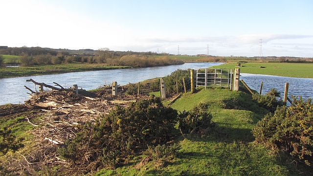
Flood debris and the Clyde Walkway
This looks like the site of an eddy when the river was in spate. There is a lot of debris piled up in one place. The walkway is often closed by floods here.
 Map © Crown Copyright")
TIP: Click the map for more Large scale mapping
- Grid Square
- NS7653, 22 images (more nearby 🔍)
- Photographer
- Richard Webb (more nearby)
- Date Taken
- Monday, 9 January, 2012 (more nearby)
- Submitted
- Tuesday, 31 January, 2012
- Subject Location
-
OSGB36:
 NS 7655 5383 [10m precision]
WGS84: 55:45.7212N 3:58.1380W - Camera Location
-
OSGB36: NS 7657 5382
- View Direction
- West-northwest (about 292 degrees)