2011
SS9045 : Signpost at Lower Horridge Wood
taken 12 years ago, near to West Luccombe, Somerset, England
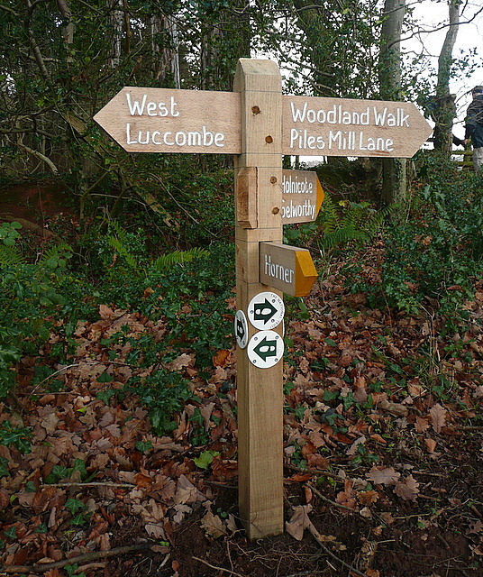
Signpost at Lower Horridge Wood
The footpath runs from Horner to Holnicote. But there is also another permissive path running through Lower Horridge Wood. This is all part of the National Trust owned Holnicote estate.
 Map © Crown Copyright")
TIP: Click the map for more Large scale mapping
- Grid Square
- SS9045, 21 images (more nearby 🔍)
- Photographer
- Graham Horn (more nearby)
- Date Taken
- Wednesday, 28 December, 2011 (more nearby)
- Submitted
- Wednesday, 1 February, 2012
- Subject Location
-
OSGB36:
 SS 9020 4592 [10m precision]
WGS84: 51:12.1144N 3:34.3793W - Camera Location
-
OSGB36: SS 9020 4592
- View Direction
- EAST (about 90 degrees)