2012
TL5049 : Field, sky and railway remains
taken 12 years ago, near to Babraham, Cambridgeshire, England
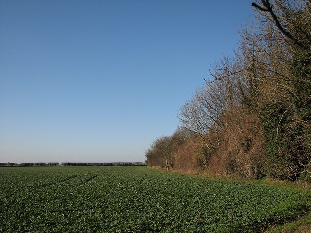
Field, sky and railway remains
The trees on the right are growing on the trackbed of the Stour Valley line, which meandered from Cambridge to Marks Tey (and eventually Colchester) via Cavendish, Long Melford and Sudbury. It opened in 1865 and closed in 1967. This is the view north-westwards from the Babraham-Pampisford road (which it crossed on a bridge), looking towards Shelford Junction and Cambridge.
 Map © Crown Copyright")
TIP: Click the map for more Large scale mapping
- Grid Square
- TL5049, 76 images (more nearby 🔍)
- Photographer
- John Sutton (more nearby)
- Date Taken
- Wednesday, 1 February, 2012 (more nearby)
- Submitted
- Thursday, 2 February, 2012
- Subject Location
-
OSGB36:
 TL 5063 4938 [10m precision]
WGS84: 52:7.3329N 0:11.9283E - Camera Location
-
OSGB36: TL 5069 4932
- View Direction
- Northwest (about 315 degrees)