2012

ST0911 : Ruin, Hackpen Mill

taken 12 years ago, near to Ashill, Devon, England
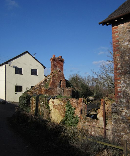
Ruin, Hackpen Mill
Ruin, Hackpen Mill
The ruins of a cottage by the lane between Ashill and Craddock.

Creative Commons Licence [Some Rights Reserved]   © Copyright Derek Harper and licensed for reuse under this Creative Commons Licence.
Geographical Context: Lowlands Village, Rural settlement Housing, Dwellings Derelict, Disused Ruin: Cottage other tags: House Click a tag, to view other nearby images.
This photo is linked from: Automatic Clusters: · Hackpen Mill [6] · Lane between Ashill and Craddock [2] · Ruins [2] ·
1:50,000 Modern Day Landranger(TM) Map © Crown Copyright
+
+
1:50,000 Modern Day Landranger(TM) Map © Crown Copyright
TIP: Click the map for more Large scale mapping
Grid Square
ST0911, 52 images   (more nearby 🔍)
Photographer
Derek Harper   (more nearby)
Date Taken
Friday, 3 February, 2012   (more nearby)
Submitted
Tuesday, 7 February, 2012
Subject Location
OSGB36: geotagged! ST 0910 1173 [10m precision]
WGS84: 50:53.8721N 3:17.6371W
Camera Location
OSGB36: geotagged! ST 0911 1171
View Direction
Northwest (about 315 degrees)
Clickable map
+
NW N NE
W Go E
SW S SE
Image classification(about): Geograph
This page has been viewed about 132 times
You are not logged in login | register