2012
NY9725 : Moorland near Gaping Stone
taken 12 years ago, near to Mickleton, County Durham, England
Moorland near Gaping Stone
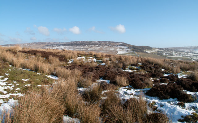
The disturbed heather moorland in this image lies to the south of a feature marked on OS Explorer OL31 as 'Gaping Stone'. At the time of the visit it was thought that this could be the Gaping Stone, (even though no stone was apparent), but the location, (assessed by GPS receiver), was later seen to be south of the supposed stone.
The distant rise is the west side of Eggleston Moor which lies beyond the valley of the Eggleston Burn.
(Note: The vicinity of the Stone was explored in a little more than a cursory inspection but no rock was seen; if it's (still) there it must be small!)
The distant rise is the west side of Eggleston Moor which lies beyond the valley of the Eggleston Burn.
(Note: The vicinity of the Stone was explored in a little more than a cursory inspection but no rock was seen; if it's (still) there it must be small!)
 Map © Crown Copyright")
TIP: Click the map for more Large scale mapping
- Grid Square
- NY9725, 14 images (more nearby 🔍)
- Photographer
- Trevor Littlewood (more nearby)
- Date Taken
- Tuesday, 7 February, 2012 (more nearby)
- Submitted
- Tuesday, 7 February, 2012
- Subject Location
-
OSGB36:
 NY 9762 2583 [10m precision]
WGS84: 54:37.6560N 2:2.3028W - Camera Location
-
OSGB36: NY 9752 2581
- View Direction
- East-northeast (about 67 degrees)