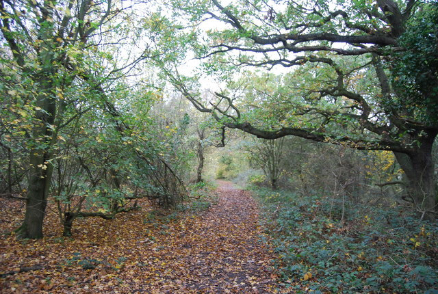
TQ7776 : Saxon Shore Way
taken 12 years ago, near to High Halstow, Medway, England
On a ridge overlooking the Thames Marshes, Northward Hill includes a lovely bluebell wood. Over 100 pairs of grey herons nest in the trees, with what is one of the UK's largest and most famous colonies of little egrets.
The reserve also includes areas of flat marshes, where lapwings, redshanks, and avocets breed.
There are many miles of trails through to the Heronry Viewpoint and some inspiring views of the Thames valley.
High Halstow NNR is 52 acres of scrub and woodland habitat, dominated by hawthorn scrub and ancient oak woodlands, with regenerating elm woodland. It is part of the larger RSPB Reserve.
The Saxon Shore Way starts at Gravesend, Kent and traces the coast as it was in the Roman times as far as Hastings in East Sussex, 163 miles (262 km) in total. The Saxon Shore Way was originally opened in 1980, but has since been re-established, and in parts re-routed and extended. It follows the coastline of the South East as it was about 1500 years ago, long before the North Kent Marshes or the Romney Marsh came into existence. The Way takes its name, The Saxon Shore, from a line of fortifications built along the coastline as it was in the 3rd Century AD.
 Map © Crown Copyright")
- Grid Square
- TQ7776, 48 images (more nearby 🔍)
- Photographer
- N Chadwick (more nearby)
- Date Taken
- Sunday, 6 November, 2011 (more nearby)
- Submitted
- Thursday, 9 February, 2012
- Subject Location
-
OSGB36:
 TQ 7787 7621 [10m precision]
WGS84: 51:27.4154N 0:33.5285E - Camera Location
-
OSGB36: TQ 7790 7620
- View Direction
- West-northwest (about 292 degrees)