2007
SD8563 : Stockdale Farm
taken 17 years ago, 4 km ESE of Langcliffe, North Yorkshire, England
This is 1 of 19 images, with title Stockdale Farm in this square
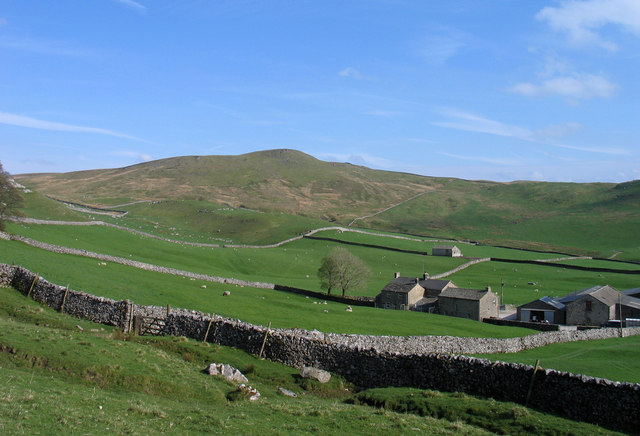
Stockdale Farm
Stockdale Farm from the route of the Pennine Bridleway. The hill beyond the fields is Rye Loaf Hill.
 Map © Crown Copyright")
TIP: Click the map for more Large scale mapping
- Grid Square
- SD8563, 51 images (more nearby 🔍)
- Photographer
- Trevor Littlewood (more nearby)
- Date Taken
- Thursday, 26 April, 2007 (more nearby)
- Submitted
- Monday, 13 February, 2012
- Subject Location
-
OSGB36:
 SD 8546 6386 [10m precision]
WGS84: 54:4.2279N 2:13.4207W - Camera Location
-
OSGB36: SD 8534 6397
- View Direction
- Southeast (about 135 degrees)