2012
ST4963 : An ivy boltmark
taken 12 years ago, near to Redhill, North Somerset, England
An ivy boltmark
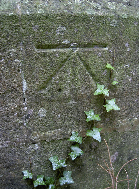
The church at Redhill has a fine 1GL boltmark in the western end, despite the encroaching vegetation. See Link for the entry in the Benchmark Database for more information on this survey mark, made as part of the Bristol to Plymouth line of 1849. Also see ST4963 : Western end of Christ Church, Redhill for a wider view of the location.
 Map © Crown Copyright")
TIP: Click the map for more Large scale mapping
- Grid Square
- ST4963, 23 images (more nearby 🔍)
- Photographer
- Neil Owen (more nearby)
- Date Taken
- Monday, 23 January, 2012 (more nearby)
- Submitted
- Tuesday, 14 February, 2012
- Subject Location
-
OSGB36:
 ST 4965 6322 [10m precision]
WGS84: 51:21.9480N 2:43.4772W - Camera Location
-
OSGB36: ST 4964 6322
- View Direction
- East-southeast (about 112 degrees)