2012
ST7519 : The river Cale
taken 12 years ago, near to Henstridge Marsh, Somerset, England
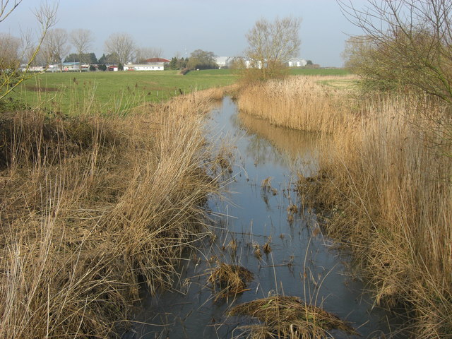
The river Cale
The tiny river Cale meanders through the water meadows. In the distance are the grain silos on the Henstridge Trading Estate and on the left of the photograph are buildings on the Gibbs Marsh Trading Estate.
 Map © Crown Copyright")
TIP: Click the map for more Large scale mapping
- Grid Square
- ST7519, 11 images (more nearby 🔍)
- Photographer
- David Redwood (more nearby)
- Date Taken
- Thursday, 9 February, 2012 (more nearby)
- Submitted
- Tuesday, 14 February, 2012
- Subject Location
-
OSGB36:
 ST 7538 1991 [10m precision]
WGS84: 50:58.6841N 2:21.1237W - Camera Location
-
OSGB36: ST 7554 1931
- View Direction
- North-northwest (about 337 degrees)