2012
TQ5365 : Railway tracks near Eynsford
taken 12 years ago, near to Eynsford, Kent, England
This is 1 of 2 images, with title Railway tracks near Eynsford in this square
Railway tracks near Eynsford
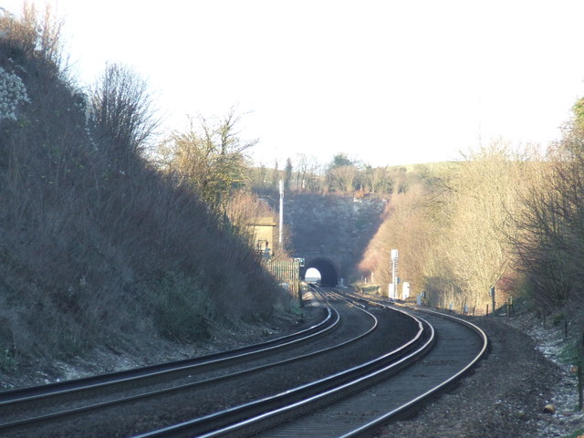
This photo was taken from the railway foot crossing near Eynsford. The tracks are electrified using the third rail system from which trains draw their power.
In front of the tunnel is the site for Lullingstone station, which was proposed in the 1930s and partly built but never opened. The full story of Lullingstone station can be found on the Kent Rail website Link The station platforms are more easily visible in this image, taken six years later: TQ5365 : Railway tracks near Eynsford
In front of the tunnel is the site for Lullingstone station, which was proposed in the 1930s and partly built but never opened. The full story of Lullingstone station can be found on the Kent Rail website Link
 Map © Crown Copyright")
TIP: Click the map for more Large scale mapping
- Grid Square
- TQ5365, 453 images (more nearby 🔍)
- Photographer
- Malc McDonald (more nearby)
- Date Taken
- Sunday, 15 January, 2012 (more nearby)
- Submitted
- Saturday, 18 February, 2012
- Subject Location
-
OSGB36:
 TQ 5332 6578 [10m precision]
WGS84: 51:22.2232N 0:12.0745E - Camera Location
-
OSGB36: TQ 5335 6573
- View Direction
- Northwest (about 315 degrees)