2012
TQ4279 : Police patrol base, Warspite Road
taken 12 years ago, near to Woolwich Ferry, Greenwich, England
This is 1 of 2 images, with title Police patrol base, Warspite Road in this square
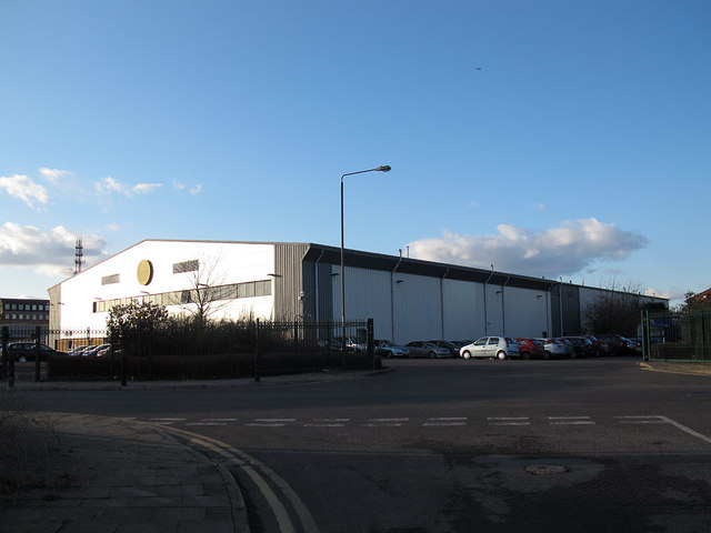
Police patrol base, Warspite Road
This anonymous warehouse unit, accessed off Ruston Road (foreground) but with an address on Warspite Road, gives no obvious clue to its occupants' business. But it is well known in the locality to be a police facility ("Greenwich patrol base"). This is public knowledge and planning permission was obtained for the change of use.
 Map © Crown Copyright")
TIP: Click the map for more Large scale mapping
- Grid Square
- TQ4279, 198 images (more nearby 🔍)
- Photographer
- Stephen Craven (more nearby)
- Date Taken
- Sunday, 19 February, 2012 (more nearby)
- Submitted
- Monday, 20 February, 2012
- Subject Location
-
OSGB36:
 TQ 421 791 [100m precision]
WGS84: 51:29.6174N 0:2.7321E - Camera Location
-
OSGB36: TQ 421 791
- View Direction
- Northwest (about 315 degrees)