2012
SU7035 : Byway in the Meon Valley
taken 12 years ago, near to Lower Farringdon, Hampshire, England
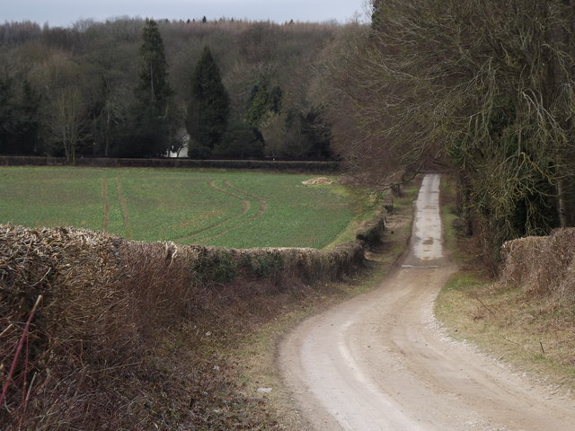
Byway in the Meon Valley
Wide loose-surfaced track descending the gentle valleyside from Upper Farringdon to the main road in the valley bottom. Hedgerows typically line the fields here.
 Map © Crown Copyright")
TIP: Click the map for more Large scale mapping
- Grid Square
- SU7035, 58 images (more nearby 🔍)
- Photographer
- Colin Smith (more nearby)
- Date Taken
- Friday, 24 February, 2012 (more nearby)
- Submitted
- Sunday, 26 February, 2012
- Subject Location
-
OSGB36:
 SU 7067 3544 [10m precision]
WGS84: 51:6.8342N 0:59.5075W - Camera Location
-
OSGB36: SU 7081 3544
- View Direction
- WEST (about 270 degrees)