2012
SD5288 : Boundary post, A65 at Barrows Green
taken 12 years ago, near to Natland, Cumbria, England
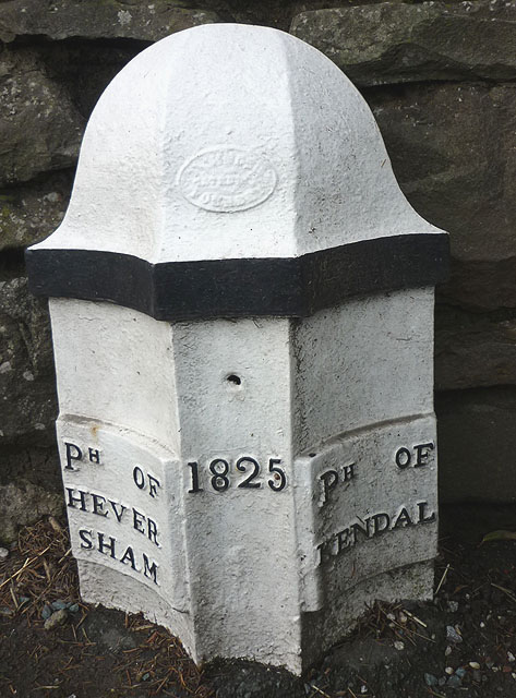
Boundary post, A65 at Barrows Green
Placed in 1825 it names the parishes of Heversham and Kendal. There must have been some re-organisation since as it currently sits on the boundary between Natland and Stainton parishes.
 Map © Crown Copyright")
TIP: Click the map for more Large scale mapping
- Grid Square
- SD5288, 36 images (more nearby 🔍)
- Photographer
- Karl and Ali (more nearby)
- Date Taken
- Friday, 2 March, 2012 (more nearby)
- Submitted
- Saturday, 3 March, 2012
- Subject Location
-
OSGB36:
 SD 5262 8833 [10m precision]
WGS84: 54:17.3033N 2:43.7603W - Camera Location
-
OSGB36: SD 5262 8833
- View Direction
- WEST (about 270 degrees)