SP9113 : Temporary Islands on Startops Reservoir
taken 12 years ago, near to Marsworth, Buckinghamshire, England
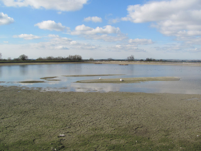
Note the large area of cracked mud in the foreground.
Startops Reservoir became very low in the Autumn of 2011, as did the adjacent Marsworth and Tringford Reservoirs. Startops only receives water from the other two reservoirs when they are full and as a result the level was still slowly falling in January 2012 and only started to rise again at the end of February. The three reservoirs supply water to the Grand Union Canal which runs immediately to the North West of Startops Reservoir.
Startopsend Reservoir was opened in 1817 to provide water for the Grand Junction Canal (now the Grand Union Canal). All but the section of the reservoir adjacent to the Marsworth Reservoir dam are in SP9113. Most of Startopsend Reservoir is in Hertfordshire, but the northernmost part is in Buckinghamshire. It differs from the other reservoirs in the area in that it has very little natural vegetation. It has the Marsworth Reservoir dam on its eastern flank, plus the road on the Tringford Reservoir dam. The Northern edge separates it from the Grand Union Canal and the South West and North West sides are also dams. It takes the overflow water from Marsworth and Tringford Reservoirs and has no direct supply of water.
 Map © Crown Copyright")
- Grid Square
- SP9113, 176 images (more nearby 🔍)
- Photographer
- Chris Reynolds (more nearby)
- Date Taken
- Tuesday, 6 March, 2012 (more nearby)
- Submitted
- Tuesday, 6 March, 2012
- Subject Location
-
OSGB36:
 SP 9194 1377 [10m precision]
WGS84: 51:48.9005N 0:40.0595W - Camera Location
-
OSGB36: SP 9204 1377
- View Direction
- WEST (about 270 degrees)