2012
SE0025 : Park Fold from Park Lane, Mytholmroyd
taken 12 years ago, near to Mytholmroyd, Calderdale, England
This is 1 of 2 images, with title starting with Park Fold from Park Lane in this square
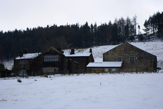
Park Fold from Park Lane, Mytholmroyd
This cluster of building now comprises around five separate dwelling Wood and Hey Edge. The main house appears to be a mid to late seventeenth century building, with later extensions.
 Map © Crown Copyright")
TIP: Click the map for more Large scale mapping
- Grid Square
- SE0025, 262 images (more nearby 🔍)
- Photographer
- Phil Champion (more nearby)
- Date Taken
- Sunday, 5 February, 2012 (more nearby)
- Submitted
- Monday, 12 March, 2012
- Subject Location
-
OSGB36:
 SE 0015 2579 [10m precision]
WGS84: 53:43.7105N 1:59.9523W - Camera Location
-
OSGB36: SE 00145 25879
- View Direction
- SOUTH (about 180 degrees)