2012
ST2091 : Sirhowy Valley Country Park signpost, Wattsville
taken 12 years ago, near to Wattsville, Caerphilly/Caerffili, Wales
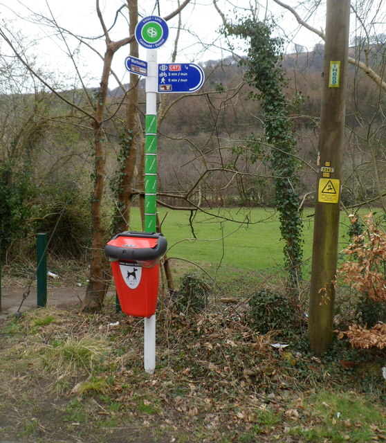
Sirhowy Valley Country Park signpost, Wattsville
At a bend in the road, one arm of the signpost points towards the residential part of Wattsville and another arm points right along this road Link towards National Cycle Route 47, ¼ mile away.
The field in the background is on the north bank of the Sirhowy River.
Short-sighted people will have a shock if they think the red box on the signpost is a postbox.
It is a dog waste receptacle!
The field in the background is on the north bank of the Sirhowy River.
Short-sighted people will have a shock if they think the red box on the signpost is a postbox.
It is a dog waste receptacle!
 Map © Crown Copyright")
TIP: Click the map for more Large scale mapping
- Grid Square
- ST2091, 116 images (more nearby 🔍)
- Photographer
- Jaggery (more nearby)
- Date Taken
- Friday, 16 March, 2012 (more nearby)
- Submitted
- Saturday, 17 March, 2012
- Subject Location
-
OSGB36:
 ST 205 913 [100m precision]
WGS84: 51:36.8935N 3:8.9755W - Camera Location
-
OSGB36: ST 205 913
- View Direction
- SOUTH (about 180 degrees)