2012
SK1373 : East Buxton lime kilns
taken 12 years ago, near to Millers Dale, Derbyshire, England
This is 1 of 6 images, with title starting with East Buxton Lime in this square
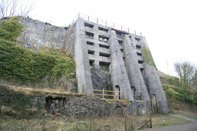
East Buxton lime kilns.
Alongside the Monsal Trail near Miller's Dale Station. These kilns operated from 1880 to 1944 and produced 50 tons of quicklime per day in a batch process. The white boxes high on the structure are for swifts as they need to launch themselves from a height when they first take to the air and can then apparently fly continuously for three years.
The kilns are built into and onto the cliff face and the draw holes are accessed through an opening blasted in the rock. The massive concrete buttresses were added in the 1920s.
The kilns are built into and onto the cliff face and the draw holes are accessed through an opening blasted in the rock. The massive concrete buttresses were added in the 1920s.
 Map © Crown Copyright")
TIP: Click the map for more Large scale mapping
- Grid Square
- SK1373, 210 images (more nearby 🔍)
- Photographer
- Chris Allen (more nearby)
- Date Taken
- Saturday, 17 March, 2012 (more nearby)
- Submitted
- Sunday, 18 March, 2012
- Subject Location
-
OSGB36:
 SK 1323 7331 [10m precision]
WGS84: 53:15.3981N 1:48.1889W - Camera Location
-
OSGB36: SK 1322 7330
- View Direction
- Northeast (about 45 degrees)