2012
NN3840 : Landslide, Loch Lyon
taken 12 years ago, near to Loch Lyon [water Feature], Perth And Kinross, Great Britain
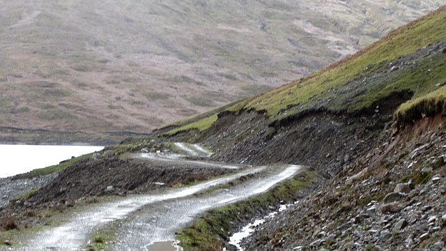
Landslide, Loch Lyon
A slope above the road had become waterlogged bringing down soil and shale onto the lochside road. The road is also under attack from below, waves on the huge reservoir are eroding the bank.
The loch is smaller than mapped by the Ordnance Survey, it is also time that the road was put on maps.
The loch is smaller than mapped by the Ordnance Survey, it is also time that the road was put on maps.
 Map © Crown Copyright")
TIP: Click the map for more Large scale mapping
- Grid Square
- NN3840, 4 images (more nearby 🔍)
- Photographer
- Richard Webb (more nearby)
- Date Taken
- Saturday, 17 March, 2012 (more nearby)
- Submitted
- Sunday, 18 March, 2012
- Subject Location
-
OSGB36:
 NN 3883 4013 [10m precision]
WGS84: 56:31.5294N 4:37.3037W - Camera Location
-
OSGB36: NN 3887 4017
- View Direction
- Southwest (about 225 degrees)