2012
NR3669 : Airigh an t-Sagairt, Islay
taken 12 years ago, 4 km NW of Ballygrant, Islay, Argyll And Bute, Scotland
This is 1 of 2 images, with title Airigh an t-Sagairt, Islay in this square
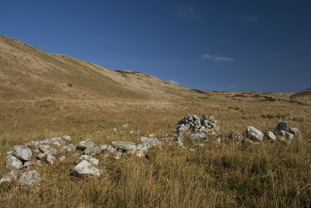
Airigh an t-Sagairt, Islay
There are lots of remains of old shielings in this now deserted hill country. This one is not marked even on the Explorer map, but shows up when magnified on the Geograph submit box.
See Link
See Link
 Map © Crown Copyright")
TIP: Click the map for more Large scale mapping
- Grid Square
- NR3669, 13 images (more nearby 🔍)
- Photographer
- Becky Williamson (more nearby)
- Date Taken
- Thursday, 22 March, 2012 (more nearby)
- Submitted
- Friday, 23 March, 2012
- Subject Location
-
OSGB36:
 NR 3669 6963 [10m precision]
WGS84: 55:50.8662N 6:12.4932W - Camera Location
-
OSGB36: NR 3669 6962
- View Direction
- North-northeast (about 22 degrees)