2012
ST8437 : 2012 : The combe with no name, Kingston Deverill
taken 12 years ago, near to Kingston Deverill, Wiltshire, England
2012 : The combe with no name, Kingston Deverill
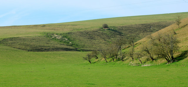
Turning our backs on the village we look into a mysterious hollow, a dry valley, bottom, or combe which I shall call Whitepits Combe, because that is the place at the bottom end, also, Whitepits Down is at the top of the hill beyond. Cold Kitchen Hill is beyond that.
OS Explorer Map 143 tells us there are ancient earthworks on the hills either side. Markings are just visible on the hill to the left.
OS Explorer Map 143 tells us there are ancient earthworks on the hills either side. Markings are just visible on the hill to the left.
 Map © Crown Copyright")
TIP: Click the map for more Large scale mapping
- Grid Square
- ST8437, 78 images (more nearby 🔍)
- Photographer
- Maurice Pullin (more nearby)
- Date Taken
- Friday, 23 March, 2012 (more nearby)
- Submitted
- Tuesday, 27 March, 2012
- Subject Location
-
OSGB36:
 ST 8453 3777 [10m precision]
WGS84: 51:8.3392N 2:13.3500W - Camera Location
-
OSGB36: ST 8462 3747
- View Direction
- North-northwest (about 337 degrees)