2012
SD5365 : Thirlmere Aqueduct
taken 12 years ago, near to Caton, Lancashire, England
This is 1 of 3 images, with title starting with Thirlmere in this square
Thirlmere Aqueduct
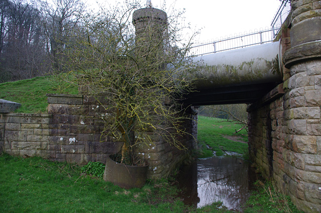
The public footpath on the north side of the river passes under the aqueduct here, but it is often water-logged.
A tree is growing out of what appears to be a spare section of water pipe.
A tree is growing out of what appears to be a spare section of water pipe.
 Map © Crown Copyright")
TIP: Click the map for more Large scale mapping
- Grid Square
- SD5365, 37 images (more nearby 🔍)
- Photographer
- Ian Taylor (more nearby)
- Date Taken
- Friday, 23 March, 2012 (more nearby)
- Submitted
- Wednesday, 28 March, 2012
- Subject Location
-
OSGB36:
 SD 5348 6585 [10m precision]
WGS84: 54:5.1868N 2:42.7587W - Camera Location
-
OSGB36: SD 5347 6585
- View Direction
- East-northeast (about 67 degrees)