2012
SK3787 : Sheffield and Tinsley Canal
taken 12 years ago, near to Sheffield, England
This is 1 of 2 images, with title Sheffield and Tinsley Canal in this square
Sheffield and Tinsley Canal
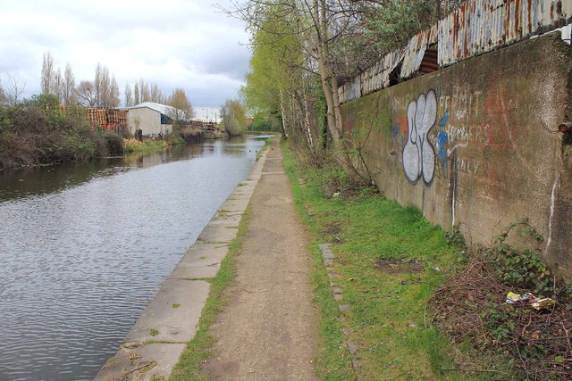
The canal just cuts across the NW corner of this grid square, and about 60 metres of the tow path from this point is in the square. Taken during the Geograph Conference 2012 first guided walk.
Sheffield and Tinsley Canal
The Sheffield and Tinsley Canal was opened in 1814 to carry boats between the navigable River Don at Tinsley and a new basin close to the heart of Sheffield. Before this date, goods had to be carried over poor roads to Tinsley Wharf on the River Don. Link
See also Link
 Map © Crown Copyright")
TIP: Click the map for more Large scale mapping
- Grid Square
- SK3787, 44 images (more nearby 🔍)
- Photographer
- David P Howard (more nearby)
- Date Taken
- Tuesday, 3 April, 2012 (more nearby)
- Submitted
- Sunday, 8 April, 2012
- Subject Location
-
OSGB36:
 SK 3702 8798 [10m precision]
WGS84: 53:23.2422N 1:26.6913W - Camera Location
-
OSGB36: SK 3700 8797
- View Direction
- East-northeast (about 67 degrees)