2012
SM7225 : Ffarm Rhosson Uchaf Farm
taken 12 years ago, near to Rhosson, Pembrokeshire/Sir Benfro, Wales
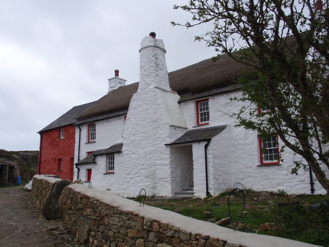
Ffarm Rhosson Uchaf Farm
Dyddia Ffarm Rhosson Uchaf o'r canol oesoedd. Mae'r hen ffermdy newydd gael ei hadnewyddu.
Rhossan Uchaf Farm dates from the middle ages. It has recently undergone much needed restoration work.
Rhossan Uchaf Farm dates from the middle ages. It has recently undergone much needed restoration work.
 Map © Crown Copyright")
TIP: Click the map for more Large scale mapping
- Grid Square
- SM7225, 226 images (more nearby 🔍)
- Photographer
- Alan Richards (more nearby)
- Date Taken
- Sunday, 8 April, 2012 (more nearby)
- Submitted
- Monday, 9 April, 2012
- Subject Location
-
OSGB36:
 SM 7291 2526 [10m precision]
WGS84: 51:52.7724N 5:18.0484W - Camera Location
-
OSGB36: SM 7294 2528
- View Direction
- West-southwest (about 247 degrees)