2012
NR6619 : Drumlemble Village Hall
taken 12 years ago, near to Drumlemble, Argyll And Bute, Scotland
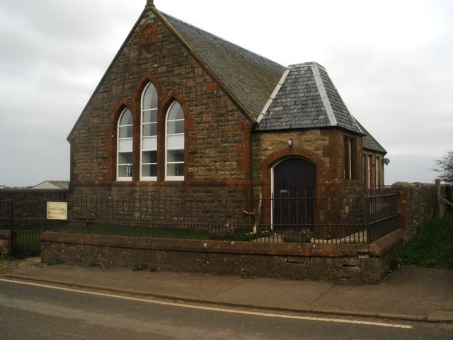
Drumlemble Village Hall
Formerly the Old Presbyterian Mission Hall. An Ordnance Survey Bench Mark, located on the East face, South-East corner, is shown at NR6619 : OS Bench Mark, Drumlemble Village Hall.
 Map © Crown Copyright")
TIP: Click the map for more Large scale mapping
- Grid Square
- NR6619, 20 images (more nearby 🔍)
- Photographer
- Derek Tootill (more nearby)
- Date Taken
- Sunday, 1 April, 2012 (more nearby)
- Submitted
- Monday, 9 April, 2012
- Subject Location
-
OSGB36:
 NR 6614 1974 [10m precision]
WGS84: 55:24.9371N 5:41.7898W - Camera Location
-
OSGB36: NR 6615 1971
- View Direction
- North-northwest (about 337 degrees)