2012
SX9786 : Exe Estuary Trail
taken 12 years ago, near to Exton, Devon, England
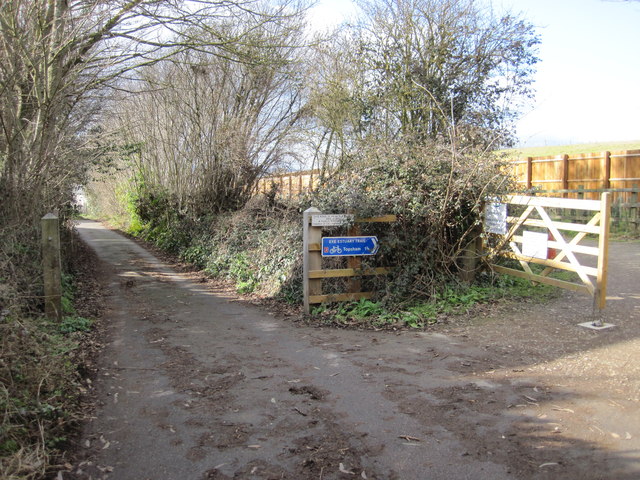
Exe Estuary Trail
The residents of Exton presumably hold some influence with the local council: After following public roads around the back of the village, the Exe Estuary Trail ends up at a short length of private road. Here, instead of using this existing road, the Trail then detours along a new path parallel to the existing road, past a sewage pumping station.
 Map © Crown Copyright")
TIP: Click the map for more Large scale mapping
- Grid Square
- SX9786, 42 images (more nearby 🔍)
- Photographer
- Brian Henley (more nearby)
- Date Taken
- Sunday, 19 February, 2012 (more nearby)
- Submitted
- Wednesday, 11 April, 2012
- Subject Location
-
OSGB36:
 SX 978 869 [100m precision]
WGS84: 50:40.3879N 3:26.8185W - Camera Location
-
OSGB36: SX 978 869
- View Direction
- West-southwest (about 247 degrees)