2012
TG5303 : Aerial photo of the Yare river mouth and Outer Harbour,
taken 12 years ago, near to South Denes, Norfolk, England
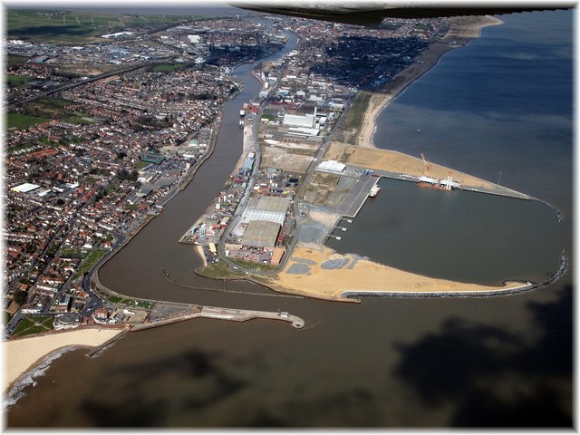
Aerial photo of the Yare river mouth and Outer Harbour,
Taken from a light plane in April 2012 this photo shows the new Outer Harbour, and the river mouth, entrance to the Inner Harbour and The Norfolk Broads - See a Daily Photo here GorlestonDP.co.uk
 Map © Crown Copyright")
TIP: Click the map for more Large scale mapping
- Grid Square
- TG5303, 200 images (more nearby 🔍)
- Photographer
- William Pitt (more nearby)
- Contributed by
- Charles Shelbourne (more nearby)
- Date Taken
- Tuesday, 10 April, 2012 (more nearby)
- Submitted
- Thursday, 26 April, 2012
- Subject Location
-
OSGB36:
 TG 5325 0377 [10m precision]
WGS84: 52:34.3641N 1:44.1599E - Camera Location
-
OSGB36: TG 5386 0300
- View Direction
- Northwest (about 315 degrees)