2012
SE0421 : Sowerby Bridge Footpath 135 (western link) at the junction with Footpath 136
taken 12 years ago, near to Triangle, Calderdale, England
This is 1 of 13 images, with title starting with Sowerby Bridge Footpath in this square
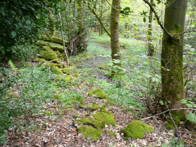
Sowerby Bridge Footpath 135 (western link) at the junction with Footpath 136
Sowerby Bridge Footpath 135 (western link) at the junction with Footpath 136 This is the start of the wet and muddy part of the path that leads to Ripponden Footpath 62. The path is actually to the right of the tree, but the foundations of the old wall are dry.
 Map © Crown Copyright")
TIP: Click the map for more Large scale mapping
- Grid Square
- SE0421, 118 images (more nearby 🔍)
- Photographer
- Humphrey Bolton (more nearby)
- Date Taken
- Thursday, 3 May, 2012 (more nearby)
- Submitted
- Saturday, 5 May, 2012
- Subject Location
-
OSGB36:
 SE 0485 2131 [10m precision]
WGS84: 53:41.2932N 1:55.6822W - Camera Location
-
OSGB36: SE 0485 2131
- View Direction
- South-southeast (about 157 degrees)