2012
NS2659 : Aircraft wreckage
taken 12 years ago, near to Blairpark, North Ayrshire, Scotland
This is 1 of 5 images, with title starting with Aircraft in this square
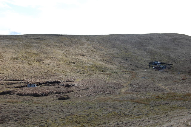
Aircraft wreckage
Wreckage from crashed plane on the side of Irish Law
 Map © Crown Copyright")
TIP: Click the map for more Large scale mapping
- Grid Square
- NS2659, 38 images (more nearby 🔍)
- Photographer
- Scott (more nearby)
- Date Taken
- Sunday, 6 May, 2012 (more nearby)
- Submitted
- Sunday, 6 May, 2012
- Subject Location
-
OSGB36:
 NS 2608 5917 [10m precision]
WGS84: 55:47.6662N 4:46.5479W - Camera Location
-
OSGB36: NS 2618 5938
- View Direction
- South-southwest (about 202 degrees)