SD4970 : Steamtown towards the end
taken 32 years ago, near to Carnforth, Lancashire, England
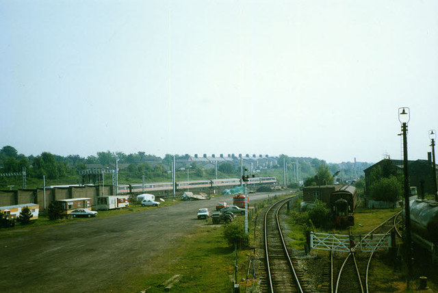
The train in the distance is a class 86-hauled southbound InterCity working on the main line.
Carnforth station, first opened in 1846, is located at the junction of the main London-Glasgow route ("West Coast Main Line"), the "Little North Western" line from Settle Junction, and the Cumbrian coast route to Barrow-in-Furness. The main line platforms have been out of use, probably since electrification in the 1960s, so only trains to Barrow and Leeds in one direction, and Lancaster and Morecambe/Heysham in the other, stop here.
The station became famous as the location for the film "Brief Encounter", set in the 1940s, and as a result has many recreated features of the period, plus a small railway museum.
Carnforth was also a major railway depot in the days of steam, and the last in Britain to remain open when British Rail ceased using steam in 1968. Later it became the Steamtown railway museum, and is currently back in operational use by West Coast Railways who operate luxury diesel-hauled charter trains. Several buildings on the site are listed: the engine shed, wagon works, water tower, coaling tower, ashing plant, preserved signal box from Selside, and the remaining operational signal box to the north of the station.
 Map © Crown Copyright")
- Grid Square
- SD4970, 325 images (more nearby 🔍)
- Photographer
- Stephen Craven (more nearby)
- Date Taken
- Monday, 25 May, 1992 (more nearby)
- Submitted
- Tuesday, 8 May, 2012
- Subject Location
-
OSGB36:
 SD 4957 7064 [10m precision]
WGS84: 54:7.7475N 2:46.3927W - Camera Location
-
OSGB36: SD 4961 7075
- View Direction
- South-southwest (about 202 degrees)