2012
SN5881 : Ground frame diagram in Aberystwyth Station
taken 12 years ago, near to Aberystwyth, Ceredigion/Sir Ceredigion, Wales
This is 1 of 3 images, with title starting with Ground in this square
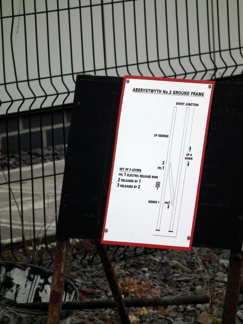
Ground frame diagram in Aberystwyth Station
Since the introduction of ERTMS signalling on the Cambrian Lines, the loop at Aberystwyth can be controlled remotely from the signalling centre at Machynlleth. However, it can also be controlled locally using the mechanical ground frames situated either end of the loop. See also SN5881 : The platform at Aberystwyth Railway Station and SN5881 : Aberystwyth No. 2 Ground Frame.
 Map © Crown Copyright")
TIP: Click the map for more Large scale mapping
- Grid Square
- SN5881, 3084 images (more nearby 🔍)
- Photographer
- John Lucas (more nearby)
- Date Taken
- Thursday, 10 May, 2012 (more nearby)
- Submitted
- Friday, 11 May, 2012
- Subject Location
-
OSGB36:
 SN 585 815 [100m precision]
WGS84: 52:24.7955N 4:4.8320W - Camera Location
-
OSGB36: SN 585 815
- View Direction
- East-southeast (about 112 degrees)