2012
SU6098 : The Crown (3) - sign, Thame Road, Stadhampton
taken 12 years ago, near to Stadhampton, Oxfordshire, England
The Crown (3) - sign, Thame Road, Stadhampton
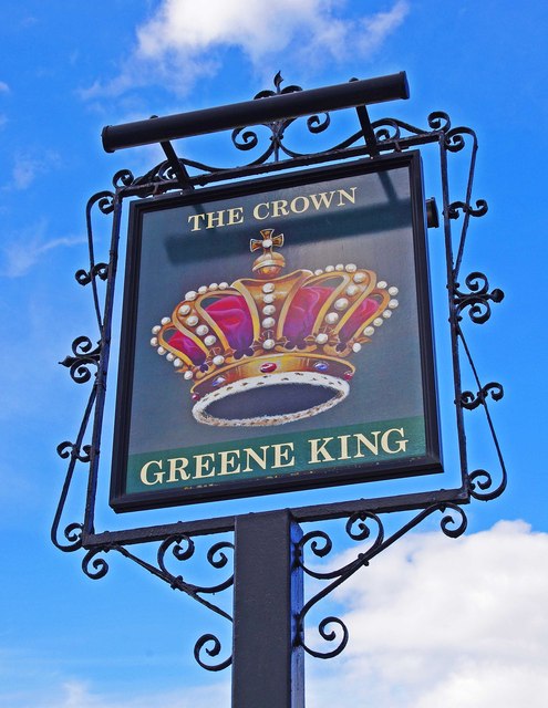
The pub's sign is at the far side of the car park. The brewers Greene King are based at Bury St. Edmunds in Suffolk, where they have a brewery. Their pubs division has around 1,600 pubs at present, and has extended well beyond their East Anglian base, particularly as they have taken over many pubs from other now defunct breweries. This includes at least one in Oxfordshire, so it is quite likely that this was how they acquired this house.
The Crown indicates loyalty to the reigning monarch. It has been used as an inn or pub sign for hundreds of years. In the past, when most people were illiterate, the sign was easily recognised by people. Usually the sign shows a representation of a crown worn by a monarch, as here, but sometimes it can show the old crown coin. The Crown is almost as popular as the Red Lion as a pub name.
SU6098 : The Crown (1), Thame Road, Stadhampton.
SU6098 : The Crown (2), Thame Road, Stadhampton.
 Map © Crown Copyright")
TIP: Click the map for more Large scale mapping
- Grid Square
- SU6098, 110 images (more nearby 🔍)
- Photographer
- P L Chadwick (more nearby)
- Date Taken
- Saturday, 12 May, 2012 (more nearby)
- Submitted
- Monday, 14 May, 2012
- Subject Location
-
OSGB36:
 SU 602 986 [100m precision]
WGS84: 51:40.9869N 1:7.7694W - Camera Location
-
OSGB36: SU 602 986
- View Direction
- North-northeast (about 22 degrees)