2012
SN7720 : Garreg Las
taken 12 years ago, 4 km S of Llanddeusant, Carmarthenshire/Sir Gaerfyrddin, Wales
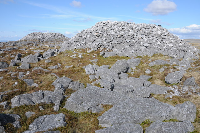
Garreg Las
The summit of Garreg Las is 635m above sea level and one of the 2,000ft summits of the Brecon Beacons. Though not a spectacular summit it is adorned by these two huge cairns. I believe the northern cairn, the further one here is the higher one and therefore the mountain's highest point.
 Map © Crown Copyright")
TIP: Click the map for more Large scale mapping
- Grid Square
- SN7720, 14 images (more nearby 🔍)
- Photographer
- Philip Halling (more nearby)
- Date Taken
- Saturday, 12 May, 2012 (more nearby)
- Submitted
- Sunday, 20 May, 2012
- Subject Location
-
OSGB36:
 SN 7773 2030 [10m precision]
WGS84: 51:52.0702N 3:46.6347W - Camera Location
-
OSGB36: SN 7772 2028
- View Direction
- North-northeast (about 22 degrees)