2012
NH5136 : Anemometer mast, Blairmore
taken 12 years ago, 4 km SSE of Camault Muir, Highland, Scotland
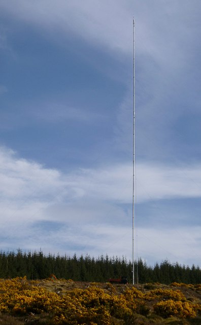
Anemometer mast, Blairmore
This rather tall mast has anemometers at a number of different heights. It is for measuring wind speed for the proposed Druim Bà wind farm.
There is a digger and tipper truck parked near the base of the mast.
There is a digger and tipper truck parked near the base of the mast.
 Map © Crown Copyright")
TIP: Click the map for more Large scale mapping
- Grid Square
- NH5136, 10 images (more nearby 🔍)
- Photographer
- Craig Wallace (more nearby)
- Date Taken
- Tuesday, 22 May, 2012 (more nearby)
- Submitted
- Wednesday, 23 May, 2012
- Subject Location
-
OSGB36:
 NH 5156 3644 [10m precision]
WGS84: 57:23.6445N 4:28.2961W - Camera Location
-
OSGB36: NH 51560 36498
- View Direction
- SOUTH (about 180 degrees)