2012
J3479 : Flyover, Greencastle, Belfast (1)
taken 12 years ago, 3 km from Newtownabbey, Co Antrim, Northern Ireland
Flyover, Greencastle, Belfast (1)
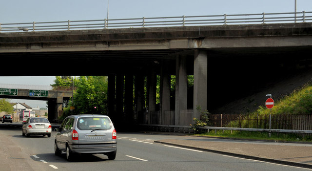
The M2 (inward and outward lanes) crossing the Shore Road. This off-slip J3479 : Motorway slip road, Greencastle, Belfast is on the right.
The M2 at Greencastle, Belfast
The Greencastle Sandyknowes (hill) section of the M2 (later incorporating the M5) opened in 1966 and served as a temporary terminus until the opening of the foreshore section, from York Street, in 1973. The junction allows inward and outward traffic to join and leave the M2 but omits a junction between the inward M5 and the outward M2 and the inward M2 and outward M5.
Loading map... (JavaScript required)
- Grid Square
- J3479, 49 images (more nearby 🔍)
- Photographer
- Albert Bridge (more nearby)
- Date Taken
- Friday, 25 May, 2012 (more nearby)
- Submitted
- Friday, 25 May, 2012
- Subject Location
-
Irish:
 J 343 797 [100m precision]
WGS84: 54:38.8800N 5:55.1850W - Camera Location
-
Irish: J 343 797
- View Direction
- North-northeast (about 22 degrees)