1980
TA1866 : Rough Seas, Bridlington Harbour 1980
taken 44 years ago, near to Bridlington, East Riding of Yorkshire, England
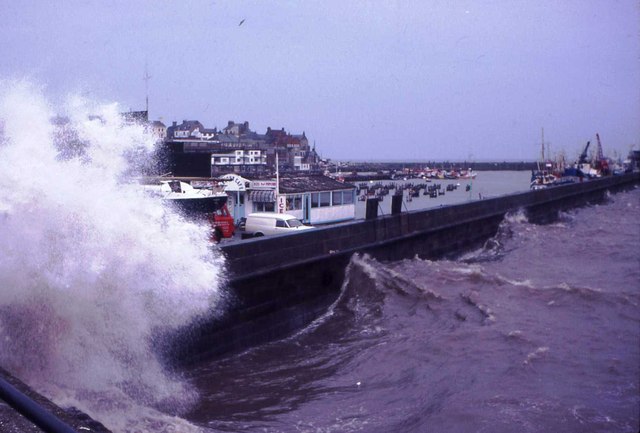
Rough Seas, Bridlington Harbour 1980
 Map © Crown Copyright")
TIP: Click the map for more Large scale mapping
- Grid Square
- TA1866, 1563 images (more nearby 🔍)
- Photographer
- John M Wheatley (more nearby)
- Date Taken
- 1980 (more nearby)
- Submitted
- Tuesday, 12 June, 2012
- Subject Location
-
OSGB36:
 TA 1828 6641 [10m precision]
WGS84: 54:4.8020N 0:11.6128W - Camera Location
-
OSGB36: TA 1824 6640
- View Direction
- East-northeast (about 67 degrees)