1985
TA0589 : Rough Seas Marine Drive, Scarborough 1985
taken 39 years ago, near to Scarborough, North Yorkshire, England
This is 1 of 2 images, with title Rough Seas Marine Drive, Scarborough 1985 in this square
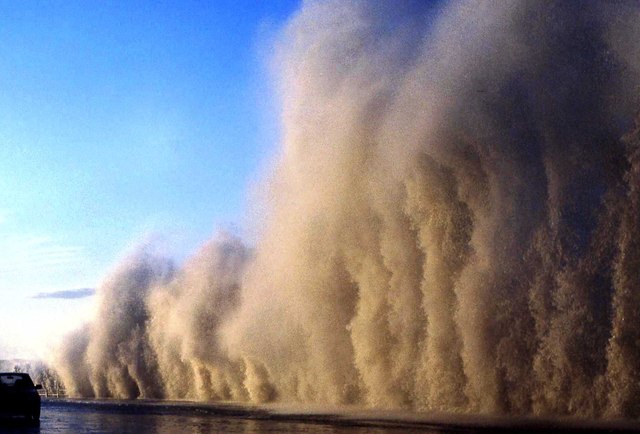
Rough Seas Marine Drive, Scarborough 1985
For nearly 100 years the sea wall bore the brunt of the wild North Sea waves. Further coastal defence works were implemented in 2002 mainly producing a rock barrier to protect the roadway.
 Map © Crown Copyright")
TIP: Click the map for more Large scale mapping
- Grid Square
- TA0589, 149 images (more nearby 🔍)
- Photographer
- John M Wheatley (more nearby)
- Date Taken
- 1985 (more nearby)
- Submitted
- Tuesday, 12 June, 2012
- Subject Location
-
OSGB36:
 TA 0507 8950 [10m precision]
WGS84: 54:17.4199N 0:23.2392W - Camera Location
-
OSGB36: TA 0508 8947
- View Direction
- North-northwest (about 337 degrees)