2012
ST3586 : Upgrade of Queen's Way, Newport
taken 12 years ago, near to Pye Corner, Newport/Casnewydd, Wales
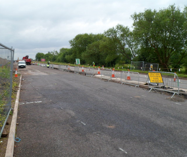
Upgrade of Queen's Way, Newport
Not to be confused with Queensway in the centre of the city, this is Queen's Way, currently an access road into Llanwern steelworks. It will soon become a road in a major development, Glan Llyn. Link
Contractor BAM Nuttall is currently (June 2012) upgrading and reconstructing the existing dual carriageway. Here, the left side of the dual carriageway is closed while work is in progress. Steelworks traffic uses the right side, where a yellow sign cautions that cyclists have priority.
Contractor BAM Nuttall is currently (June 2012) upgrading and reconstructing the existing dual carriageway. Here, the left side of the dual carriageway is closed while work is in progress. Steelworks traffic uses the right side, where a yellow sign cautions that cyclists have priority.
 Map © Crown Copyright")
TIP: Click the map for more Large scale mapping
- Grid Square
- ST3586, 51 images (more nearby 🔍)
- Photographer
- Jaggery (more nearby)
- Date Taken
- Tuesday, 12 June, 2012 (more nearby)
- Submitted
- Wednesday, 13 June, 2012
- Subject Location
-
OSGB36:
 ST 352 865 [100m precision]
WGS84: 51:34.4176N 2:56.1858W - Camera Location
-
OSGB36: ST 351 865
- View Direction
- EAST (about 90 degrees)