2012
SD7571 : Clapham Bottoms
taken 12 years ago, 3 km from Clapham, North Yorkshire, England
This is 1 of 2 images, with title Clapham Bottoms in this square
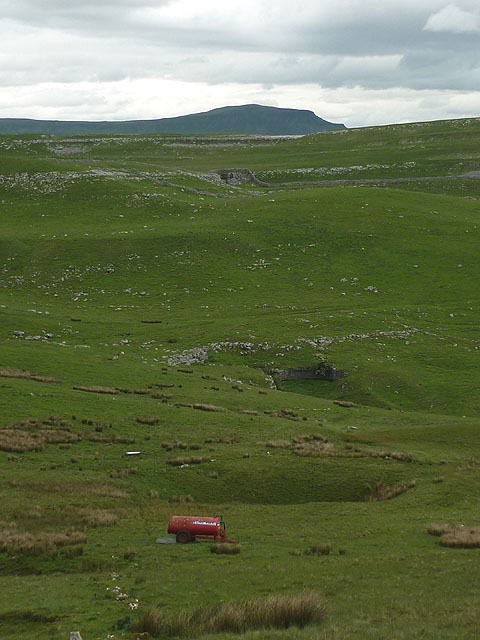
Clapham Bottoms
A huge limestone depression pitted by shakeholes. Pen-y-Ghent peers over the far skyline. I'm not sure what the red tanker is doing up here?
 Map © Crown Copyright")
TIP: Click the map for more Large scale mapping
- Grid Square
- SD7571, 96 images (more nearby 🔍)
- Photographer
- Karl and Ali (more nearby)
- Date Taken
- Tuesday, 12 June, 2012 (more nearby)
- Submitted
- Friday, 15 June, 2012
- Subject Location
-
OSGB36:
 SD 7587 7195 [10m precision]
WGS84: 54:8.5686N 2:22.2522W - Camera Location
-
OSGB36: SD 7566 7187
- View Direction
- East-northeast (about 67 degrees)