2005
TQ2173 : Richmond Park near the Beverley Brook
taken 19 years ago, near to Roehampton, Wandsworth, England
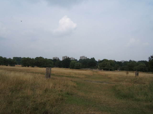
Richmond Park near the Beverley Brook
This image was taken from approx TQ 211 735. The Beverley Brook runs from right to left on the line of the trees. Tower blocks on the Alton Estate can be seen above the trees.
 Map © Crown Copyright")
TIP: Click the map for more Large scale mapping
- Grid Square
- TQ2173, 93 images (more nearby 🔍)
- Photographer
- Roger Miller (more nearby)
- Date Taken
- Saturday, 23 July, 2005 (more nearby)
- Submitted
- Sunday, 24 July, 2005
- Subject Location
-
OSGB36:
 TQ 21 73 [1000m precision]
WGS84: 51:26.8478N 0:15.1795W