2012
H5025 : The Diamond area, Clones
taken 12 years ago, near to Clones, Co Monaghan, Ireland
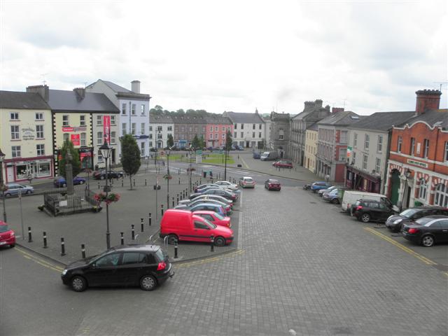
The Diamond area, Clones
Looking SSE from the front of the Church of Ireland entrance - the Diamond consists of two areas, paved in the foreground and a grass section beyond.
The Diamond
A feature of Ulster towns and villages on both sides of the border. It was English and Scottish settlers who laid out the towns with a "diamond" at their centre.
Loading map... (JavaScript required)
- Grid Square
- H5025, 121 images (more nearby 🔍)
- Photographer
- Kenneth Allen (more nearby)
- Date Taken
- Monday, 18 June, 2012 (more nearby)
- Submitted
- Wednesday, 20 June, 2012
- Subject Location
-
Irish:
 H 501 258 [100m precision]
WGS84: 54:10.7422N 7:13.9253W - Camera Location
-
Irish: H 501 258
- View Direction
- East-southeast (about 112 degrees)