NZ3768 : South Pier
taken 12 years ago, near to Tynemouth, North Tyneside, England
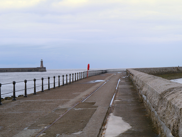
Before the construction of the two piers, the mouth of the River Tyne was exposed to the full force of the sea and many ships were frequently wrecked, especially on Black Midden Rocks.
The building of the north and south piers has been recorded as one of the most difficult undertakings of its kind carried out in this country; for over 54 years it was an endless battle against the sea. The foundation stones for the piers were laid in 1854 and, although they were initially completed in 1895, the north pier was breached two years later and its reconstruction wasnt finally completed until 1909. The north pier is 899 metres long and the south is 1,570 metres long. The distance between the round heads of the two piers is 360 metres.
The lighthouses were erected on the pier heads in 1895. Installation of the lanterns added an extra eight months to complete construction before they began operating in 1896.
The north lighthouse is 26 metres high and has a white navigation light over-arcing the horizon for a distance of 26 miles. The south Pier lighthouse is 15 metres high and has white, red and green navigational lights over-arcing the horizon for distances of 13, 9 and 8 miles respectively. Within the harbour entrance on the Herd Groyne is a smaller, red, lighthouse which is 13 metres high.
LinkPort of Tyne (pdf format)
 Map © Crown Copyright")
- Grid Square
- NZ3768, 93 images (more nearby 🔍)
- Photographer
- David Dixon (more nearby)
- Date Taken
- Sunday, 17 June, 2012 (more nearby)
- Submitted
- Friday, 22 June, 2012
- Subject Location
-
OSGB36:
 NZ 378 683 [100m precision]
WGS84: 55:0.4752N 1:24.6028W - Camera Location
-
OSGB36: NZ 376 681
- View Direction
- Northeast (about 45 degrees)