2012
SK5638 : Rescue practice
taken 12 years ago, near to Wilford, Nottingham, England
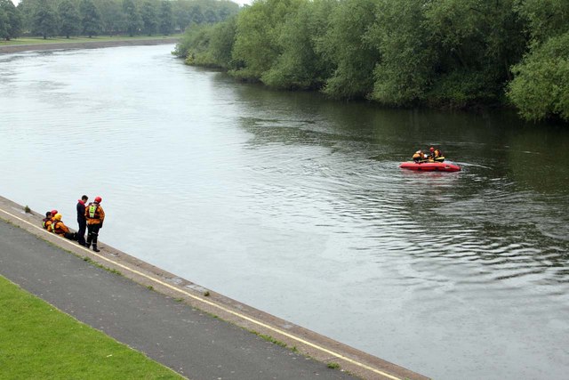
Rescue practice
At Wilford Bridge the Nottinghamshire Fire and Rescue service were practising their water-based skills, including capsizing and rerighting their inflatable boat.
River Trent
The River Trent is the third longest river in England (185 miles). It rises on Biddolph Moor, Staffordshire, then follows a generally north east to northerly path to join the River Ouse at Trent Falls. The Ouse & Trent combined form the Humber Estuary.
It is a very important river, economically having a number of Power Stations and industrial sites along its banks. It is navigable as far as Burton-On-Trent.
Wikipedia: Link
 Map © Crown Copyright")
TIP: Click the map for more Large scale mapping
- Grid Square
- SK5638, 467 images (more nearby 🔍)
- Photographer
- Alan Murray-Rust (more nearby)
- Date Taken
- Thursday, 21 June, 2012 (more nearby)
- Submitted
- Friday, 22 June, 2012
- Subject Location
-
OSGB36:
 SK 5698 3809 [10m precision]
WGS84: 52:56.2315N 1:9.2186W - Camera Location
-
OSGB36: SK 5693 3817
- View Direction
- South-southeast (about 157 degrees)