2012
SE9532 : Cave Wold Radio Station, Riplingham
taken 12 years ago, near to Riplingham, East Riding of Yorkshire, England
This is 1 of 4 images, with title starting with Cave Wold Radio Station in this square
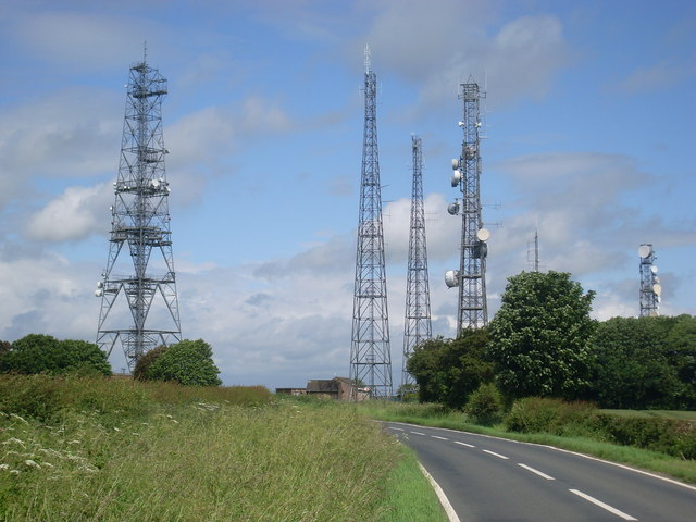
Cave Wold Radio Station, Riplingham
Situated in South Cave Road, this radio station has a network of radio masts which are used by utilities and other bodies for communication purposes. The radio tower on the far left of the photo is one of a network of British Telecom microwave radio stations used for long distance telephone communications. It is fitted with red aircraft warning lights, so that it can be seen at night for miles around. The postcode of this radio station is HU15 1QT.
 Map © Crown Copyright")
TIP: Click the map for more Large scale mapping
- Grid Square
- SE9532, 36 images (more nearby 🔍)
- Photographer
- David Hillas (more nearby)
- Date Taken
- Friday, 29 June, 2012 (more nearby)
- Submitted
- Saturday, 30 June, 2012
- Subject Location
-
OSGB36:
 SE 9533 3239 [10m precision]
WGS84: 53:46.7474N 0:33.2883W - Camera Location
-
OSGB36: SE 9534 3237
- View Direction
- North-northwest (about 337 degrees)