2012
TQ2065 : Fire Path - Keep Clear
taken 12 years ago, near to Tolworth, Kingston Upon Thames, England
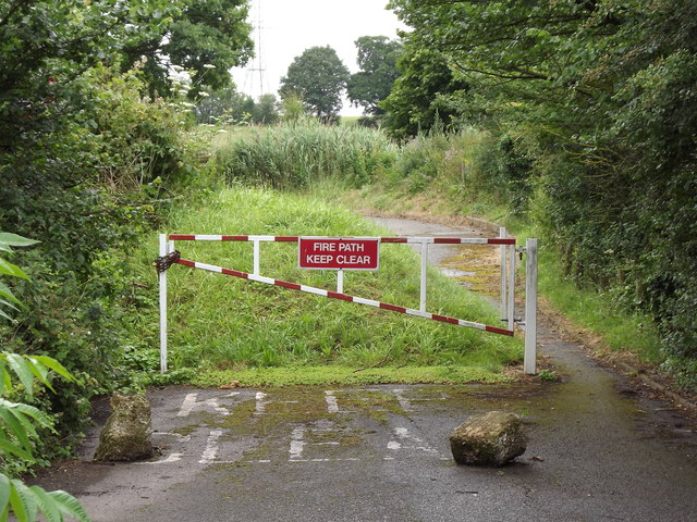
Fire Path - Keep Clear
Barrier across the Old Kingston Road near to Tolworth Court Farm. This was once the main road between Epsom and Kingston-Upon-Thames.
 Map © Crown Copyright")
TIP: Click the map for more Large scale mapping
- Grid Square
- TQ2065, 89 images (more nearby 🔍)
- Photographer
- Colin Smith (more nearby)
- Date Taken
- Tuesday, 3 July, 2012 (more nearby)
- Submitted
- Tuesday, 3 July, 2012
- Subject Location
-
OSGB36:
 TQ 2030 6534 [10m precision]
WGS84: 51:22.4628N 0:16.3810W - Camera Location
-
OSGB36: TQ 2029 6531
- View Direction
- North-northeast (about 22 degrees)