2007
TL9733 : River Stour, Nayland, Suffolk/Essex border
taken 17 years ago, near to Nayland, Suffolk, England
This is 1 of 2 images, with title River Stour, Nayland, Suffolk/Essex border in this square
River Stour, Nayland, Suffolk/Essex border
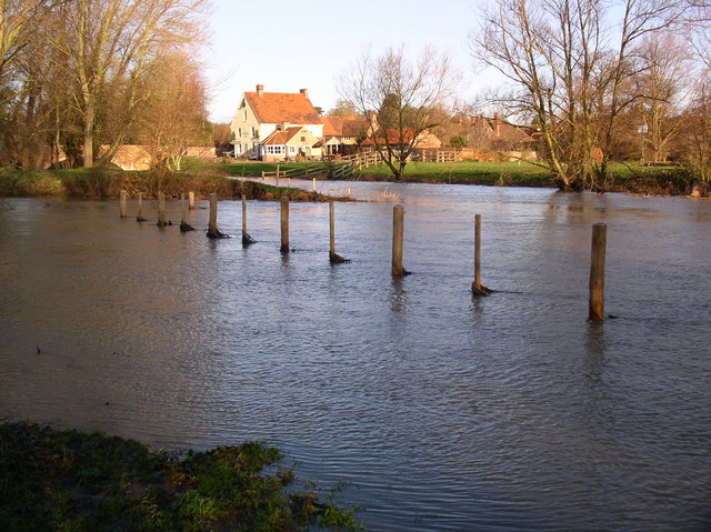
The River Stour, in flood, looking north to the Anchor Inn in Nayland (which is in the next square). This photo shows the point where the river and its relief channel join, south of the village.
 Map © Crown Copyright")
TIP: Click the map for more Large scale mapping
- Grid Square
- TL9733, 22 images (more nearby 🔍)
- Photographer
- John Lemay (more nearby)
- Date Taken
- Monday, 1 January, 2007 (more nearby)
- Submitted
- Monday, 1 January, 2007
- Subject Location
-
OSGB36:
 TL 973 339 [100m precision]
WGS84: 51:58.1127N 0:52.2455E - View Direction
- NORTH (about 0 degrees)