2012
SP0813 : Track to Stowell Grove
taken 12 years ago, near to Yanworth, Gloucestershire, England
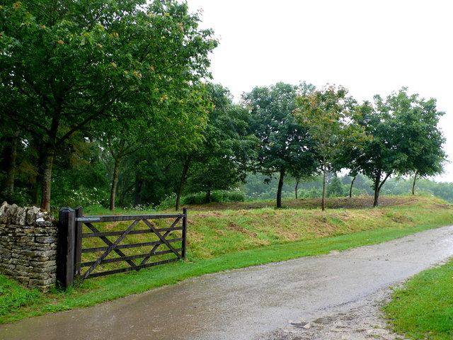
Track to Stowell Grove
This partially tarmacked track carries the Monarchs way long distance footpath towards Oxpens farm in SP7507 where it meets up with the Macmillan Way. It was originally a track from Stowell House.
 Map © Crown Copyright")
TIP: Click the map for more Large scale mapping
- Grid Square
- SP0813, 39 images (more nearby 🔍)
- Photographer
- Nigel Mykura (more nearby)
- Date Taken
- Monday, 2 July, 2012 (more nearby)
- Submitted
- Wednesday, 4 July, 2012
- Subject Location
-
OSGB36:
 SP 0852 1348 [10m precision]
WGS84: 51:49.1929N 1:52.6678W - Camera Location
-
OSGB36: SP 0855 1341
- View Direction
- North-northwest (about 337 degrees)