2006
SX6473 : Lane and bridleway, Sherberton
taken 18 years ago, near to Hexworthy, Devon, England
Lane and bridleway, Sherberton
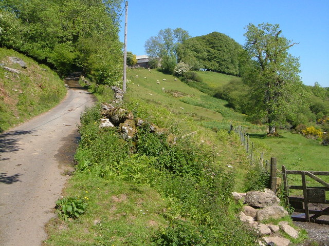
Dartmoor Forest Bridleway 27 goes through the gate on the road to reach SX6473 : Stepping stones across the Swincombe across the River Swincombe, which is just to the right. The public road on the left ends when it reaches the farm at Sherberton, a building at which can be seen ahead. But Dartmoor Forest Bridleway 13 continues onto the moor beyond.
 Map © Crown Copyright")
TIP: Click the map for more Large scale mapping
- Grid Square
- SX6473, 42 images (more nearby 🔍)
- Photographer
- Derek Harper (more nearby)
- Date Taken
- Friday, 9 June, 2006 (more nearby)
- Submitted
- Saturday, 7 July, 2012
- Subject Location
-
OSGB36:
 SX 6466 7319 [10m precision]
WGS84: 50:32.5664N 3:54.6849W - Camera Location
-
OSGB36: SX 6467 7316
- View Direction
- North-northwest (about 337 degrees)