2012
SZ3189 : Hurst Castle basement
taken 12 years ago, near to Keyhaven, Hampshire, England
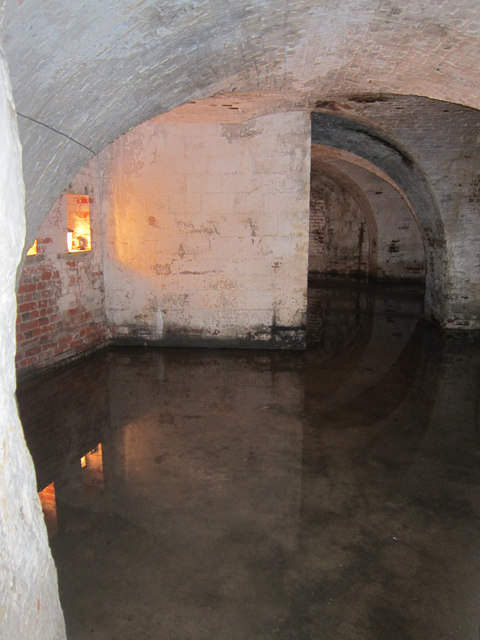
Hurst Castle basement
Hurst Castle is a Henrician Castle, one of Henry VIII's Device Forts, built at the end of a Hurst Spit, at the west end of the Solent to guard the approaches to Southampton.
The castle is only accessible by foot, along the spit, or by boat.
See other images of Hurst Castle
The castle is only accessible by foot, along the spit, or by boat.
See other images of Hurst Castle
 Map © Crown Copyright")
TIP: Click the map for more Large scale mapping
- Grid Square
- SZ3189, 437 images (more nearby 🔍)
- Photographer
- Oast House Archive (more nearby)
- Date Taken
- Saturday, 30 June, 2012 (more nearby)
- Submitted
- Saturday, 7 July, 2012
- Subject Location
-
OSGB36:
 SZ 317 897 [100m precision]
WGS84: 50:42.3806N 1:33.0700W - Camera Location
-
OSGB36: SZ 317 897
- View Direction
- EAST (about 90 degrees)