2012
SU9150 : Footpath Diversion
taken 12 years ago, near to Normandy, Surrey, England
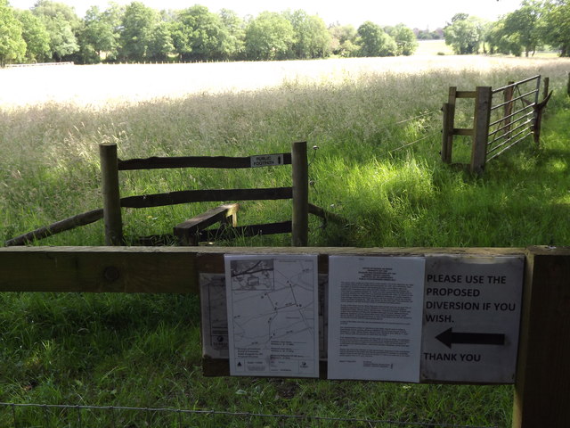
Footpath Diversion
The path cutting diagonally across this grassy field is still permissible but it is being diverted around the northern and western edges.
 Map © Crown Copyright")
TIP: Click the map for more Large scale mapping
- Grid Square
- SU9150, 32 images (more nearby 🔍)
- Photographer
- Colin Smith (more nearby)
- Date Taken
- Wednesday, 11 July, 2012 (more nearby)
- Submitted
- Wednesday, 11 July, 2012
- Subject Location
-
OSGB36:
 SU 9160 5094 [10m precision]
WGS84: 51:15.0170N 0:41.3349W - Camera Location
-
OSGB36: SU 9159 5094
- View Direction
- East-northeast (about 67 degrees)